Showing posts with label earthquakes. Show all posts

Tuesday, September 10, 2013

PLANETARY TREMORS: Very Powerful 6.6 Magnitude Quake Strikes Guatemala Causing Panic Among Residents - Many Reports Of Damage And Injuries; Houses Collapse; Landslides Block Highways; Blackout In Some Areas; Quake Felt In Neighboring Countries; The 11th Magnitude 6.0 Or Over Tremor In JUST 8 DAYS!

September 06, 2013 - GUATEMALA - A 6.6-magnitude earthquake shook Guatemala's Pacific coastline on Friday evening, causing some adobe homes to collapse in a town near the epicenter. There were  immediate reports of injuries.


USGS earthquake location - Terrain View.

The U.S. Geological Survey said the epicenter was 6 kilometers (3 miles) south of the small town of Pajapita, near the border with Mexico, and 168 kilometers west of Guatemala City. It had a depth of 67 kilometers (41 miles).

EMSC is giving a magnitude of 6.5 at a depth of 95km. Both calculations show that this was a deep earthquake.


USGS earthquake location - Satellite View.

Guatemala's fire department issued a statement saying some poorly-built homes were destroyed in the town of Patzicia, located between the epicenter and the capital city. The Central American nation's natural disaster agency said that at least three uninhabited homes collapsed, and two highways were blocked by landslides.

Reports of Damage:


1:42 UTC:
-4 homes collapsed in San Miguel Sigüila, Quetzaltenango.
-A house collapsed in the village of San Sebastián Lemoa, Quiché.
-2 women were injured in San Marcos.
-There are damaged houses in Patzicia, Chimaltenango.
-A house caught on fire due to the quake in Tiquisate, Escuintla
-Damage can be seen on the roof of Rafael Landívar University.
-Ceiling fell on the Enriquez passageway in Xela.

1:14 UTC: There are collapsed and heavily damaged houses around Quetzaltenango. Also 1 person has been injured by falling debris in there.

1:08 UTC: Unconfirmed reports indicate that 3 houses, damaged on last years quake, have collapsed with no people inside.

1:03 UTC: People have been injured, most of them from traffic accidents.

12:49 UTC: There are reports of damaged houses as well as collapsed walls around Guatemala. A very big landslide has been reported in kilometer 214.

12:44 UTC: USGS expects that 41,000 people felt  a Very Strong shaking (Mercalli Scale of VII), 1,351,000 a strong shaking (MMI of VI) and almost 4 million people feeling a Moderate shaking (MMI V). If these values are correct then this is a very dangerous earthquake.

12:39 UTC: Damage has been reported in San Marcos, Guatemala. Broken windows have been observed in a municipal building of San Marcos.

12:37 UTC: Power is out in some locations around Guatemala. Landslides could had happened since the area has been hit by hard rains lately.

The quake was felt strongly in the capital of Guatemala City, and caused blackouts in some areas, but authorities did not immediately report any damage there.

"People living in Guatemala City's tall buildings were panicked," said Eddy Sanchez, director of Guatemala's National Institute of Seismology.


USGS earthquake shakemap intensity.


People ran outside their homes and some motorists stopped their cars in the capital. An aftershock of a lower magnitude further frightened capital-dwellers.

Eye-Witness Reports - USGS:


Guatemala City - The house started shaking and it got a little worse but is was only scary for a few seconds.
San Pedro La Laguna - Lasted about 40 seconds. Mild at first, everything stated rumbling when it peaked
Panajachel, Guatemala - I was on the phone with my mother who was calling from Panajachel as it happened, she said it was pretty strong and everyone was running outside.
Guatemala, City - very strong shaking :
Guatemala City - (I'm a pilot staying overnight in Guatemala City at the Crown Plaza by the airport. On the second floor my bed started moving as I watched TV and progressively got worse for about 10 seconds then subsided. A very weak aftershock occurred 5-10 min later. So far no damage can be seen.
Pacoxom - Light fixture swayed, dishes rattled, we exited house.
Quetzaltenango - On second floor of colonial hotel in center a good 30 second shake - quickly exited down stairs and out to the street with a number of other people as it stopped. Some folks were shaken up. Every cell phone was out. As others, felt aftershock about 10 minutes later - maybe 5-10 seconds in duration. And life goes on...
San Pedro La Laguna, Lago Atitlan - Everything was shaking, things fell of the shelf, I ran outside and all my puppies were crying.
Quetzaltenango - very strong shaking small items have fallen,
San Marcos La Laguna - My apartment was shaking very strongly for what felt like a minute or two. Lots of noise as windows and refrigerator and pots/pans shook. Only one small item fell on the floor, and no other visible damage, but the noise and shaking were quite strong.

Eye-Witness Reports - EMSC:


Panajachel - No objects knocked down, but good amount of shaking and seemed to be an aftershock w/in 5-10 minutes.
Guatemala - I felt my knees shake. And I ran out the door.
Antigua / Guatemala - was sitting on the bed with some friends watching a movie when the room began to shake and books fell off the shelves. ran outside and the ground continued to roll for a few seconds. moderate shaking - felt one weaker aftershock so far.
San Cristobal de las casas, Mexico - Started to feel the sway while at my desk. I ran outside and it lasted for what seemed to be about a minute. I am still feeling things settle into place, several minutes later.
Guatemala City - It was horrible.
Santa Cruz la Laguna - A few seconds. Nothing major.
San Jose Chacaya - Moderate shaking but very long... about 15 sec.
San Pedro La Laguna - Ground shook. What else to say?
Quetzaltenango - the quake was strong and long. still feeling aftershocks.
Guatemala City - Yea I was sitting on my bed then felt a little shake and boom it hit
Buena Vista - We have an Academy here and the block walls were waving up and down.
san marcos la laguna solola guatemala - I have a restaurant here in the village centre and the shake took bottles of the shelves.The building shook quiet a lot
Ciudad de Guatemala - stuff shook!
Antigua / Guatemala - the roof started creaking first and then the ground began to move. i got into a reinforced doorway and then the whole house began to roll like on a giant wave. no damage, other than to nerves
Guatemala City - Closet and shower door were moving. It went on about a minute.
Guatemala City - Shaking side to side in my hotel
Santa Cruz la Laguna - I felt shaking for approx. 15 seconds. Not as bad as the one in the fall of 2012, which was 7.2. Slight aftershock.
Antigua - light shaking felt inside and outside. small after tremor
centro dos south of nuva concepcion - Reading a book when it started felt pretty strong nothing broke here just a long period of shaking
Antigua - I was looking up information in Wikipedia on the Island of Garbage in the pacific, and also learning some icelandic when, Bam, here it comes, and I'm like, today is far too hung over a day to die.
Zone 14 Guatemala City - On floor 12 multi axis shaking 90 seconds with several aftershocks. On phone with person across town who also felt it. Strongest felt in 2 years.
Panajachel - The bed and closet units started moving around, floor shaking, lasted about 30 seconds, no damage!
Antigua - My 3 story hotel was rocking...pretty strong.


The temblor was also felt in neighboring Mexico and El Salvador, but there were no immediate reports of injuries or damage in those countries.


Google earthquake location.

Friday's temblor was one of the strongest in Guatemala since a 7.4-magnitude earthquake last November killed 42 people in the country's west. That quake was the strongest in 36 years and left thousands of people homeless and without electricity or water. 

SOURCES: ABC News | Earthquake Report.


Tectonic Summary.
The September 7, 2013 (UTC) Guatemala earthquake (Mw6.6) occurred near the west coast of Guatemala in the Middle American trench. The event occurred at or near the interface between the Cocos and North America plates.   The style of faulting based on the W-phase source mechanism indicates slip likely occurred on a shallow thrust fault consistent with the subduction interface.  At the latitude of this event, the Cocos plate moves towards the north-northeast with respect to the North American plate at a rate of 78 mm/yr.

The broad scale tectonics of the western and southwestern coast of Central America are dominated by the northeastward subduction of the Cocos oceanic plate beneath the North America plate. Thrust- and normal-type earthquakes are a common occurrence along this plate boundary and the Guatemala region, with events occurring both within the subduction zone and in the overriding plate. Over the past 40 years, 27 events of M6.0 or greater have occurred within 300km of the September 2013 event. Events of note in this region include earthquakes on November 2012 Mw7.4 offshore of Guatemala, which killed 39 people; September 1993 M­w­7.2 offshore of Chiapas, Mexico, which killed one person; and December 1983 Mw7.0 offshore of Guatemala. Other early 20th century earthquakes in the Guatemala region include August 1942 Mw7.9, which killed 38 and April 1902 M7.5, which killed more than 5000 people.


Seismotectonics Of The Caribbean Region And Vicinity.
Extensive diversity and complexity of tectonic regimes characterizes the perimeter of the Caribbean plate, involving no fewer than four major plates (North America, South America, Nazca, and Cocos). Inclined zones of deep earthquakes (Wadati-Benioff zones), ocean trenches, and arcs of volcanoes clearly indicate subduction of oceanic lithosphere along the Central American and Atlantic Ocean margins of the Caribbean plate, while crustal seismicity in Guatemala, northern Venezuela, and the Cayman Ridge and Cayman Trench indicate transform fault and pull-apart basin tectonics. 

Along the northern margin of the Caribbean plate, the North America plate moves westwards with respect to the Caribbean plate at a velocity of approximately 20 mm/yr. Motion is accommodated along several major transform faults that extend eastward from Isla de Roatan to Haiti, including the Swan Island Fault and the Oriente Fault. These faults represent the southern and northern boundaries of the Cayman Trench. Further east, from the Dominican Republic to the Island of Barbuda, relative motion between the North America plate and the Caribbean plate becomes increasingly complex and is partially accommodated by nearly arc-parallel subduction of the North America plate beneath the Caribbean plate. This results in the formation of the deep Puerto Rico Trench and a zone of intermediate focus earthquakes (70-300 km depth) within the subducted slab. Although the Puerto Rico subduction zone is thought to be capable of generating a megathrust earthquake, there have been no such events in the past century. The last probable interplate (thrust fault) event here occurred on May 2, 1787 and was widely felt throughout the island with documented destruction across the entire northern coast, including Arecibo and San Juan. Since 1900, the two largest earthquakes to occur in this region were the August 4, 1946 M8.0 Samana earthquake in northeastern Hispaniola and the July 29, 1943 M7.6 Mona Passage earthquake, both of which were shallow thrust fault earthquakes. A significant portion of the motion between the North America plate and the Caribbean plate in this region is accommodated by a series of left-lateral strike-slip faults that bisect the island of Hispaniola, notably the Septentrional Fault in the north and the Enriquillo-Plantain Garden Fault in the south. Activity adjacent to the Enriquillo-Plantain Garden Fault system is best documented by the devastating January 12, 2010 M7.0 Haiti strike-slip earthquake, its associated aftershocks and a comparable earthquake in 1770. 

Moving east and south, the plate boundary curves around Puerto Rico and the northern Lesser Antilles where the plate motion vector of the Caribbean plate relative to the North and South America plates is less oblique, resulting in active island-arc tectonics. Here, the North and South America plates subduct towards the west beneath the Caribbean plate along the Lesser Antilles Trench at rates of approximately 20 mm/yr. As a result of this subduction, there exists both intermediate focus earthquakes within the subducted plates and a chain of active volcanoes along the island arc. Although the Lesser Antilles is considered one of the most seismically active regions in the Caribbean, few of these events have been greater than M7.0 over the past century. The island of Guadeloupe was the site of one of the largest megathrust earthquakes to occur in this region on February 8, 1843, with a suggested magnitude greater than 8.0. The largest recent intermediate-depth earthquake to occur along the Lesser Antilles arc was the November 29, 2007 M7.4 Martinique earthquake northwest of Fort-De-France. 


USGS earthquake historic seismicity.

The southern Caribbean plate boundary with the South America plate strikes east-west across Trinidad and western Venezuela at a relative rate of approximately 20 mm/yr. This boundary is characterized by major transform faults, including the Central Range Fault and the Boconó-San Sebastian-El Pilar Faults, and shallow seismicity. Since 1900, the largest earthquakes to occur in this region were the October 29, 1900 M7.7 Caracas earthquake, and the July 29, 1967 M6.5 earthquake near this same region. Further to the west, a broad zone of compressive deformation trends southwestward across western Venezuela and central Columbia. The plate boundary is not well defined across northwestern South America, but deformation transitions from being dominated by Caribbean/South America convergence in the east to Nazca/South America convergence in the west. The transition zone between subduction on the eastern and western margins of the Caribbean plate is characterized by diffuse seismicity involving low- to intermediate-magnitude (Magnitude less than 6.0) earthquakes of shallow to intermediate depth. 

The plate boundary offshore of Colombia is also characterized by convergence, where the Nazca plate subducts beneath South America towards the east at a rate of approximately 65 mm/yr. The January 31, 1906 M8.5 earthquake occurred on the shallowly dipping megathrust interface of this plate boundary segment. Along the western coast of Central America, the Cocos plate subducts towards the east beneath the Caribbean plate at the Middle America Trench. Convergence rates vary between 72-81 mm/yr, decreasing towards the north. This subduction results in relatively high rates of seismicity and a chain of numerous active volcanoes; intermediate-focus earthquakes occur within the subducted Cocos plate to depths of nearly 300 km. Since 1900, there have been many moderately sized intermediate-depth earthquakes in this region, including the September 7, 1915 M7.4 El Salvador and the October 5, 1950 M7.8 Costa Rica events. 

The boundary between the Cocos and Nazca plates is characterized by a series of north-south trending transform faults and east-west trending spreading centers. The largest and most seismically active of these transform boundaries is the Panama Fracture Zone. The Panama Fracture Zone terminates in the south at the Galapagos rift zone and in the north at the Middle America trench, where it forms part of the Cocos-Nazca-Caribbean triple junction. Earthquakes along the Panama Fracture Zone are generally shallow, low- to intermediate in magnitude (Magnitude less than 7.2) and are characteristically right-lateral strike-slip faulting earthquakes. Since 1900, the largest earthquake to occur along the Panama Fracture Zone was the July 26, 1962 M7.2 earthquake. -USGS.

Friday, August 9, 2013

RATTLE & HUM: Unexplained Phenomena - Researcher Declares That Mysterious Windsor Hum Is REAL?!

August 02, 2013 - CANADA - Colin Novak has hunch about where hum is originating, but won't reveal location until fall. 


A University of Windsor professor studying the Windsor Hum is convinced it's real. 

Colin Novak set up a state-of-the-art, $250,000 recording station in a woodlot in the western part of the Ontario city in February. It's a virtual ear, tuned to record the hum 24/7. 

Novak and a group of fellow scientists and researchers from the University of Windsor and London's University of Western Ontario received federal funding to study the mysterious noise

When the sound he's looking for rises above a certain level it's registered on the equipment and Novak gets an email. 

He said for the last month or so, his inbox has been full. 

Ottawa is funding research of the mysterious Windsor Hum.CBC News

"Some of the evenings, we may get 30 or 40 emails in a given night, mostly between midnight and about 3:30 a.m.," Novak said. 

That's enough to convince him the hum is real. 

"We're in a pretty remote area in the night time. There's some construction activity happening right now, but at night, there's not too much out here.... when we're getting levels as high as we are, there's definitely some activity," he said. 

The equipment's location hasn't been made public, but it's located in an area where the hum has been heard by Windsor residents. 

Novak said he has an idea where the sound is coming from, but he won't speculate until his research is finished. 

He and his partners will report their findings to the federal government by the end of the year. 

"And from that point forward, I think it may become more of a political, and an engineering problem," Novak said. 

People who live in the area have some theories of their own as to where the sound is originating. 

Archie Cormier is a Windsor resident who claims to hear the noise. 

Google.

"It's on the American side, and it doesn't do it all the time," he said of the noise. "So, if they can pinpoint the problem, then maybe they could find a solution." 

Last year, a federal study suggested the hum may originate from the U.S. side of the Detroit River, in the general area of Zug Island, an area of concentrated steel production and manufacturing in River Rouge, Mich. 

The mayor of River Rouge said in 2011 that his city didn't have the funds to investigate the hum. 

The map below shows the location of Zug Island, southwest of Detroit. - CBC News.

Saturday, June 22, 2013

3MIN News June 17 2013 & Large Quake Analysis, Energy from Space and How to watch the Sun

Suspicious0bservers released a special today with his 3/4MIN News update. Here is a quote about the large earthquake analysis. This is a 7 minute video as a result.

Description from Suspicious0bservers in relation to this update - "It is important to know that many factors are involved in building pressure underground, and many others involved in triggering earthquakes. Not all coronal holes produce quakes and not all major upticks in seismicity occur with coronal holes. But the 100,000 plus people here have been watching a statistically significant correlation in upticks of that very seismicity. An uptick has begun again, the coronal holes are set. Not every such situation creates the danger, but it seems the danger prefers these situations. "


If you missed it, here is Suspicious0bservers 'Energy from Space' video which he references during the above mention.


And the 36 minute 'How to Watch the Sun' is below, which is a much see to what Suspicious0bservers has been trying to teach/show everyone through his well researched work.


Saturday, May 25, 2013

Will there be a significant earth event within the next two weeks and if so, what might it be? - Wren's Day with Tarot

Via Wren's Day with Tarot, 22 May 2013

Go away for a few days, come back, log on and oh my!!
Not sure if U.S. weather can get more ugly although some say that geo-engineering has NOT reached its potential, if you get my drift.
I had to look up Kamchatka on a map.


We are NOT out of the woods yet. There is nearly another two weeks of impending potential disasters.

Is it possible that we cannot ever predict anything with accuracy because the universe never gives you exactly what you think will happen, but a variation that you never expected. Moreover, perhaps precisely because you look to one thing you become blind to another. Hummm, what do you think?

Will there be a significant earth event within the next two weeks and if so, what might it be?

The center/focus card is a Major Arcana, Balance (R); clearly out of balance. To the left is another Major Arcana, Stag. The Universe is in all of us and therefore we are subject to its laws and actions. We must face with purpose and strength whatever imbalance that is about to arrive. To the right is the Ace of Arrows, The Breath of Life reset which indicates something rising up from the ground and it is all headed toward the Page of Vessels, Otter attentively watching the swift flowing river for something coming from upstream.

It hardly matters what draw I make, the cards, although pointing to different scenarios are all pointing to basically the same thing; some catastrophe followed by a reset.


Climate Risk Scientist, Doctor Simon Atkins has raised the probability percentage of a tsunami related event occurring in the North Atlantic from 26% to 38% overnight, because of recent events. 38% isn't a very big percentage. I'm thinking Iceland.

Earthquakes around the NA Craton for seven days up to May 21 -

fracking dormant volcanic earthquakes may 21 2013

Bomb Shelter Boom Sees Underground Pools, Basketball Courts

I wasn't able to find any crop circles listed for May 2013.

Thursday, May 23, 2013

Earthquakes from Space


Via Dan Zen, @ http://viewzone2.com/gravitywavesx.html

by Dan Eden for ViewZone

As usual, viewzone gave me an assignment that seemed literally out of this world. They asked me to investigate the theory that some major earthquakes can be caused by explosions far, far away in the universe. Although I'm not entirely convinced that this can happen, the evidence is pretty convincing.

The Earthquake in Chile (8.8)
Before we discuss the material below we need to mention the earthquake that happened in Chile on February 27, 2010. There are now many reports coming in that strange lights were seen in the sky a few hours before the event [below].


This was what people saw i the evening sky in Chile -- just hours before the earthquake.


[above:] This image was taken just hours before the powerful 7.9 earthquake in Sechuan, China, on May 12, 2008.

This was recorded in Tianshui, Gansu province, about 450km northeast of epicenter, by someone using a cell phone. The Chinese earthquake killed about 70,000 people.

In February 2009, a growing number of American and Chinese scientists openly proclaimed that the calamity was triggered by a four-year-old reservoir built too close to the earthquake's geological fault line. A Columbia University scientist who studied the quake has said that it may have been triggered by the weight of 320 million tons of water in the Zipingpu Reservoir less than a mile from this well-known major fault. His conclusions, presented to the American Geophysical Union in December, coincide with a new finding by Chinese geophysicists that the dam caused significant seismic changes before the earthquake.

Strange lights in the sky have been reported for many years in regions where earthquakes follow by a few hours. Until now the link between these lights and the earthquakes has been a mystery. Now scientists may have a clue about what is producing both phenomenon. The following theory suggests that some of these powerful earth moving events may have their origin in space, while others may be man made. However in both circumstances, the strange lights may serve as an efficient warning of underground stress and impending danger.

Earthquakes from Space


The idea started with one of the most powerful earthquakes that was ever recorded -- the magnitude 9.3 earthquake that occurred in the Indian Ocean off the coast of Sumatra in Malaysia on December 26th, 2004. It caused a powerful tsunami which devastated coastal regions of many countries leaving over 240,000 people either dead or missing. It was the worst tsunami to affect this area since the 1883 explosion of Krakatao. The earthquake that produced it was so strong that it exceeded by a factor of 10 the next most powerful earthquake to occur anywhere in the past 25 years.

Just 44.6 hours later, scientists were shocked to see that gamma ray telescopes orbiting the Earth picked up the arrival of the brightest gamma ray burst ever recorded! The Gamma ray burst (or GRB) arrived from deep space on December 27, 2004 at 21 hours 36 minutes (Universal Time) and was 100 times more intense than any burst that had been previously recorded. It equaled the brightness of the full Moon but radiated most of its energy at gamma ray wavelengths. The blast temporarily changed the shape the Earth's ionosphere, distorting the transmission of long-wavelength radio signals.

Was there a relationship between these two dramatic events? Perhaps.


When stars die, they typically expand and give off a lot of energy. If a star is large enough, the core will collapse and a tremendous amount of energy will be released in a supernova explosion. This is so powerful that a single supernova will be brighter than an entire galaxy full of hundreds of billions of stars! But the very brightest supernovae, the biggest stars that explode, can produce ultra-powerful jets that shoot out in opposite directions. If one of those jets (which are really narrow, only about one degree wide) is pointed directly at us, we get bathed in a whole lot of extra energy even beyond what a supernova can do, and that's called a gamma ray burst.

Gamma rays are the most lethal form of radiation. These are the kind of rays that kill people from an atomic blast. The gamma rays can penetrate deep inside biologic tissue and alter molecular structures and rip apart the very basis of life. We are extremely lucky that we have not experienced a close encounter with a gamma ray burst -- most have been many light years away -- because if we had, you would not be reading this.

Gamma ray bursts are detected frequently in our universe. Most of the bursts are outside our Milky Way Galaxy, far, far away. Satellites detect these bursts and report on their position and strength, often allowing astronomers to look at the sources and try to understand what causes them. Although most are thought to be collapsing stars or black holes, others remain a mystery.

Gamma Rays and Gravity waves
Astronomers have theorized that gamma ray bursts might travel in association with gravity wave bursts. The same events, such as a rapidly collapsed star, which cause the release of gamma rays also is thought to make a "ripple" in the time-space continuum that is manifested as a gravity wave.


The "Crab Nebula" is the remnant shell of a star that exploded many years ago. At the time it collapsed on itself, it would have sent out powerful gamma ray bursts and gravity waves.

In the course of their flight through space, gamma rays would be deflected by gravitational fields and would be scattered by dust and cosmic ray particles they encountered, so they would be expected to travel slightly slower than their associated gravity wave burst which would pass through space unimpeded.

In this analogy, if space were a liquid, gamma rays would be energy traveling through the liquid whereas the gravity wave would be the waves of the liquid itself.

After a 45,000 year light-speed journey, a gamma ray burst arrival delay of 44.6 hours (as in the case of the December 2004 earthquake/gamma ray burst) would not be unexpected. It amounts to a delay of just one part in 9 million.

So if the gravity wave traveled at the speed of light (c), the gamma ray burst would have averaged a speed of 0.99999989 c, just 0.11 millionths slower. There is also the possibility that at the beginning of its journey the gravity wave may have had a superluminal (greater than velocity of c) speed.

But the gravity waves are not always created at the same instant as the gamma ray bursts. The rapid collapse of a star produces a gravity wave and may precede the formation of the gamma ray beams which originate from the poles of the collapsed star. So it is possible that the gravity waves get a "head start" in advance of the GRBs.

Still with me on this? Here's what's going on so far:

Collapsing stars release massive amounts of energy that travel outward in the form of powerful gamma rays, called gamma ray bursts. These huge explosions last only minutes but can be detected from orbiting satellites. These violent explosion also causes a ripple in the very fabric of space-time -- like a stone thrown in a pond -- and travel outward as a gravity wave. Both the gamma rays and gravity wave propagate outward at different speeds, often reaching the earth at different times.
So What is a Gravitational Wave?
Most scientists describe gravitational waves as "ripples in space-time." Just like a boat sailing through the ocean produces waves in the water, moving masses like stars or black holes produce gravitational waves in the fabric of space-time. A more massive moving object will produce more powerful waves, and objects that move very quickly will produce more waves over a certain time period.

Where Do Gravitational Waves Come From?
Gravitational waves are usually produced in an interaction between two or more compact masses. Such interactions include the binary orbit of two black holes, a merge of two galaxies, or two neutron stars orbiting each other. As the black holes, stars, or galaxies orbit each other, they send out waves of "gravitational radiation" that reach the Earth. However, once the waves do get to the Earth, they are extremely weak. This is because gravitational waves, like water waves, decrease in strength as they move away from the source. Even though they are weak, the waves can travel unobstructed within the 'fabric' of space-time. This how they are able to reach the Earth and provide us with information that light cannot give.

Gravitational waves have two important and unique properties. 

First, there is no need for any type of matter to be present nearby in order for the waves to be generated by a binary system of uncharged black holes, which would emit no electromagnetic radiation. Second, gravitational waves can pass through any intervening matter without being scattered. Whereas light from distant stars may be blocked out by interstellar dust, for example, gravitational waves will pass through unimpeded. These two features allow gravitational waves to carry information about astronomical phenomena never before observed by humans.

What are the effects of a passing gravitational wave?
[Top Right]The effect of a plus-polarized gravitational wave on a ring of particles.
[Bottom right]The effect of a cross-polarized gravitational wave on a ring of particles.
Imagine a perfectly flat region of spacetime, with a group of motionless test particles lying in a plane. Then, a weak gravitational wave arrives, passing through the particles along a line perpendicular to the plane of the particles. What happens to the test particles? Roughly speaking, they will oscillate in a "cruciform" manner, as shown in the animations. The area enclosed by the test particles does not change, and there is no motion along the direction of propagation. In the animation at the right, the wave would be passing from you, through the screen, and out the back.

The foregoing animation is the result of a pair of masses that orbit about each other (e.g., black holes) on a circular orbit or a rotating rod or dumbbell. In this case the amplitude, A, of the gravitational wave is a constant, but its plane of polarization changes or rotates (at twice the orbital or rotating-rod rate) and so the time-varying gravitational wave size or periodic spacetime strain h, exhibits a variation as shown in the animation. If the orbit is elliptical or the rotating rod's centrifugal-force change varies during rotation, then the gravitational wave's amplitude (that is, the amplitude of the periodic spacetime h), A, actually also varies with time according to an equation called the "quadrupole".

The effect of Gravity Waves on the Earth
In his 1983 Ph.D. dissertation, Paul LaViolette called attention to terrestrial dangers of Galactic core explosions, pointing out that the arrival of the cosmic ray superwave they produced would be signaled by a high intensity gamma ray burst which would also generate a strong gravity wave that might be expected to travel forward at the forefront of this superwave and might be the first indication of a superwave's arrival. He pointed out that such gravity waves could induce substantial tidal forces on the Earth during their passage which could induce earthquakes and cause polar axis torquing effects.

If a gravity wave can distort the space between matter, even on a small scale, the cumulative effect of the earth's core, with its dense mass, and the mantle could result in movement of the crust. The result would be an earthquake.

While we still do not know the relationship of the arrival on earth of the gamma ray burst and the gravity wave, we would expect that they should coincide within several hours of eachother for near sources, to many days of eachother if the source is distant. Sometimes we would expect an observed GRB to follow a seismic event by as much as 48 hours (for very distant yet powerful objects) and they may precede seismic events by as much as a few days or a week, owing to the time needed for mantle and core stress to affect the faults.
To test this hypothesis, we have researched the most notable gamma ray bursts from 1967 to the present.


Strong Gamma Ray Burst (date)Earthquake Reported (date)
GRB 20100319A -- This gamma ray blast, on March 19, 2010, was recorded by the SWIFT satellite at 18:34:50 Universal Time at RA 18:33:46 DEC -08:32:13.On March 20, 2010 at 18:08:09 Universal Time, a magnitude5.6 occurred in Guantanamo, Cuba. Location: 19.731 N, 75.279 W; Depth 17.2 km (10.7 miles)On March 20, 2010 at 14:00:51 Universal Time, a magnitude6.2 occurred in Papua, New Guinea. Location: 3.380 S, 152.231 E; 423.5 km (263.2 miles)
GRB 20100317A -- This gamma ray blast, on March 17, 2010, was recorded by the SWIFT satellite at 04:43:54 Universal Time at RA 11:40:04 DEC -46:18:51.On March 17, 2010 a magnitude 5.4 occurred in South Sumatra. Location 4.701 S, 102.757 E, depth 67.9 kn (42.2 miles).
Very unusual group of Gamma Ray Bursts!GRB 20100316A -- This gamma ray blast, on March 16, 2010, was recorded by the SWIFT satellite at 02:23:00 Universal Time at RA 16:48:07 DEC 71:49:31.
GRB 20100316B -- This gamma ray blast, on March 16, 2010, was recorded by the SWIFT satellite at 08:01:36 Universal Time at RA 10:53:59 DEC -45:28:47.
GRB 20100316C -- This gamma ray blast, on March 16, 2010, was recorded by the SWIFT satellite at 08:57:59 Universal Time at RA 02:09:09 DEC -68:00:32.
GRB 20100316D -- This gamma ray blast, on March 16, 2010, was recorded by the SWIFT satellite at 12:44:50 Universal Time at RA 07:10:27 DEC -56:16:40.
GRB 20100316E -- This gamma ray blast, on March 16, 2010, was recorded by the SWIFT satellite at 13:37:41 Universal Time at RA 22:01:01 DEC -52:12:09.
On March 15, 2010 at 18:54:23 Universal Time, a magnitude4.8 occurred in Sumatra, Indonesia. Location: 1.161 N, 97.103 E; Depth 39.1 km (24.3 miles)On March 16, 2010 at 09:44:18 Universal Time, a magnitude5.8 occurred in Japan. Location: 52.160 N, 142.206 E; Depth 24.1 km (15.0 miles)
On March 16, 2010 at 11:07:15 Universal Time, a magnitude4.7 occurred in Greater Los Angeles, California. Location: 33.9992 N, 118.082 E; Depth 18.9 km (11.7 miles)
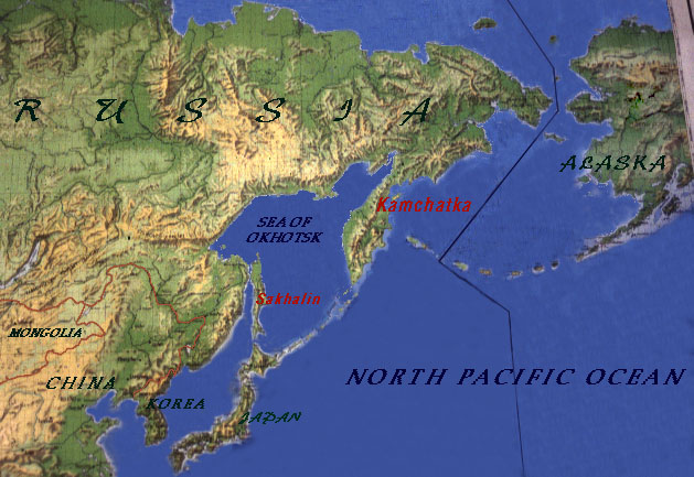
On March 16, 2010 at 11:04:00 Universal Time, a magnitude4.4 occurred in Sakhalin, Russia. Location: 53.759 N, 142.362 E; Depth 10.0 km (6.2 miles)
On March 16, 2010 at 12:25:26 Universal Time, a magnitude5.4 occurred in Fiji Region. Location: 17.668 N, 178.827 E; Depth 566.1 km (351.8 miles) - extremely deep!
On March 17, 2010 at 00:22:32 Universal Time, a magnitude5.1 occurred in South of Tonga. Location: 24.190 N, 175.943 E; Depth 33.9 km (21.1 miles)
GRB 20100305A -- This gamma ray blast, on March 05, 2010, was recorded by the SWIFT satellite at 09:05:38 Universal Time at RA 11:13:27 DEC 42:22:34. This burst had a single peak lasting about 20 seconds. The XRT started observing the field 139 seconds after the trigger, finding a bright uncatalogued x-ray source within the BAT error circle. The UVOT also imaged the field, but it found no optical candidate in its 122 second unfiltered image.On March 08, 2010 a magnitude 6.0 occurred in Eastern Turkey, killing 51 people with aftershocks magnitude 5.5A 4.4-magnitude earthquake struck Hawaii on Monday evening, according to the U.S. Geological Survey. March 08, 2010 The quake struck about 6:30 p.m. (11:30 p.m. ET) and was 19.3 miles (31.1 km) deep. The epicenter was 13 miles (20 km) southwest of the coastal region of Laupahoehoe and 189 miles (304 km) east of Honolulu, the USGS said.
GRB 20100302A -- This gamma ray blast, on March 02, 2010, was recorded by the SWIFT satellite at 19:53:06 Universal Time at RA 13:-1:22 DEC 74:34:50. Swift slewed immediately to this burst, which consisted of a broad peak that started about 40 seconds after the trigger and lasted about 35 seconds. The XRT began observing the field 125 seconds after the trigger, finding a bright, fading, uncatalogued x-ray source within the BAT error circle. The UVOT made a 150 second unfiltered exposure beginning 132 seconds after the trigger, but no OC was seen.On March 3, 2010 a magnitude 6.4 occurred in Taiwan. Location: 22.903 N, 120.823 E; Depth 23.1 km (14.4 miles)
GRB 20100219A -- This gamma ray blast, on February 19, 2010, was recorded by the SWIFT satellite at 15:15:46 Universal Time at RA 10:16:52 DEC -12:33.32On February 27, 2010 a magnitude 8.8 occurred off the coast of Chile. It was the strongest earthquake to strike the region in 50 years and generated a tsunami that impacted the entire Pacific rim area.Magnitude 7.0, Friday, February 26, 2010 at 20:31:27 UTC, Location: 25.902 N, 128.417 E; Depth 22 km (13.7 miles); Region: RYUKYU ISLANDS, JAPAN
GRB 100111A -- This gamma ray blast, on January 11, 2010, was recorded by the SWIFT satellite at 04:12:49 Universal Time at RA 16:28:09 DEC 15:33:24On January 12, 2010 a magnitude 6.8 occurred in Haiti, destroying buildings and infrastructure and causing over 200,000 deaths.
GRB 100103A On January 03, 2010 at 17:41:03 -- This burst had a duration of 40 seconds.The Swift satellite observed the field 54 seconds after the INTEGRAL trigger, finding an uncatalogued x-ray source with the XRT. No source was found with the UVOT, with lower limits v > 20.44, u > 20.70 (GCN 10310). Additional Swift/XRT observations showed that the source was fading approximately 55 hours after the trigger, thus confirming that it was the GRB afterglow (GCN 10313).''January 03, 2010, Magnitude 7.1 in SOLOMON ISLANDS. Sixteen homes destroyed, at least 60 damaged and 1,000 people left homeless on Rendova. Some of the damage was caused by a tsunami, with a runup height of 2-3 m on Rendova. Felt (VI) at Gizo. The tsunami was recorded at the following tide stations with these wave heights (peak-to-trough): 2 cm at Cape Ferguson and 15 cm at Rosslyn Bay, Australia; 13 cm at Honiara, Solomon Islands; 1 cm at Luganville, Vanuatu.
GRB 091123 on November 23, 2009 -- This burst was extremely unusual. The GBM light curve showed four emission peaks separated by long quiet periods. However, comparison with Konus-Wind data showed that the burst was already occurring when its position rose above the limb of the Earth as seen from Fermi. Using only the GBM data the burst duration was 650 seconds.NOV 24, 2009 magnitude 6.8 in TONGA.
GRB 091003 on October 03, 2009 -- ''This burst had multiple peaks. It lasted approximately 21 seconds. The spectrum was fit by a Band function with alpha = -1.13 +/- 0.01, beta = -2.64 +/- 0.24 and Epeak = 486.2 +/- 23.6 keV.OCT 04, 2009 magnitude 6.6 MORO GULF, MINDANAO, PHILIPPINES.
GRB 090929N on September 29, 2009 -- The BAT light curve for this burst has a complex structure with multiple peaks from T-10 seconds to T+50 seconds. Additional weaker peaks are seen at T+150 seconds, with the peak count rate occurring approximately 40 seconds after the trigger. The satellite slewed immediately to the burst and began XRT observations 84 seconds after the trigger. A bright, uncatalogued x-ray source was found within the BAT error circle. The UVOT also imaged the field starting 93 seconds after the trigger. In a 97 second unfiltered exposure there is not OC found.September 29, 2009 magnitude 8.1 in the SAMOA ISLANDS REGION. At least 149 people killed in Samoa, 34 killed in American Samoa and 9 killed, 7 injured and 500 displaced on Niuatoputapu, Tonga. Widespread damage to infrastructure occurred at Pago Pago, American Samoa, in many parts of Samoa and on Niuatoputapu, Tonga. Nearly all of the casualties and damage was caused by large tsunamis, with run up heights of 12 m at Poloa, 7 m at Pago Pago and Tula, American Samoa and 3 m on Niuatoputapu. Felt (V) at Apia, Samoa and (IV) at Ili`ili and Tafuna, American Samoa. Felt in much of American Samoa, Samoa and northern Tonga and as far away as Wallis and Futuna Islands. The tsunami was recorded with the following wave heights (peak-to-trough) on these selected tide stations: 411 cm at Pago Pago, American Samoa; 140 cm at Apia, Samoa; 111 cm at Rarotonga, Cook Islands; 64 cm in the Chatham Islands, 37 cm at Raoul, 21 cm at Tauranga, 14 cm at Gisborne, 11 cm at Wellington, New Zealand; 28 cm at Nuku`alofa, Tonga; 29 cm at Papeete, French Polynesia; 25 cm at Luganville, Vanuatu; 36 cm at Honolulu, Hawaii; 22 cm at Point Kemblao, Australia; 66 cm at Crescent City and 26 cm at Los Angeles, California; 42 cm at Cabo San Lucas, Mexico; 11 cm at Old Harbor and 4 cm at Seward, Alaska; 36 cm at Ofunato, Japan; 27 cm on Baltra, Ecuador; 73 cm at Antofagasta and 40 cm at Valparaiso, Chile.September 30, 2009 magnitude 7.5 in SOUTHERN SUMATRA, INDONESIA. At least 1,117 people killed, 1,214 injured, 181,665 buildings destroyed or damaged and about 451,000 people displaced in the Padang- Pariaman area. Landslides disrupted power and communications in the area. Felt (VII) at Padang; (VI) at Bukittinggi; (IV) at Bengkulu, Duri, Mukomuko and Sibolga; (III) at Pekanbaru. Also felt (IV) at Gunungsitoli, Nias and (II) at Jakarta, Java. Felt throughout Sumatra and in much of Java. Felt (III) in Singapore and at George Town, Johor Bahru, Kuala Lumpur, Petaling Jaya, Shah Alam and Sungai Chua, Malaysia. Felt in much of Peninsular Malaysia and as far away as Chiang Mai, Thailand. A 27-cm (center-to-peak) local tsunami was recorded at Padang, Sumatra.
GRB 090922A on September 22, 2009 -- The main pulse of this burst lasted 10 seconds, and it was followed by a weaker pulse approximately 60 seconds later. The total burst duration was about 92 seconds. The time-averaged spectrum was fit by a Band function with alpha = -0.77 +/- 0.05, beta = -2.28 +/- 0.07 and Epeak = 139.3 +/- 6.6 keV.September 21, 2009 magnitude 6.1 BHUTAN. At least eleven people killed and dozens injured in Mongar and Tashigang. Many buildings destroyed and many roads damaged throughout Bhutan. Cracks appeared in buildings at Guwahati, India. Felt (VI) at Tashigang and (IV) at Thimphu, Bhutan. Also felt at Tshongdue. Felt (II) at Calcutta, India. Also felt at Barpeta, Bidhannagar, Dispur, Guwahati, Kalimpong, Mussoorie, Nagaon, Nalbari, North Dum Dum, Patna, Shillong, Silchar, Tezpur and Tura. Felt in northern Bangladesh, at Lhasa, China and at Kathmandu, Nepal.
GRB 090904B on September 02, 2009 -- This burst had a single bright pulse lasting about 21 seconds. It was also independently detected by the INTEGRAL SPI-ACS. The spectrum was fit by a Band function with alpha =-0.696 +/- 0.012, beta = -3.85 +0.21/-0.31 and Epeak = 775 +/- 11 keV. The burst was also seen in the LAT (GCN 9867).September 02, 2009 magnitude 7.0 in JAVA, INDONESIA. At least 81 people killed, more than 1,297 injured, 25,000 displaced and severe damage in western Java, including at least 30 people killed and 27 missing due to a landslide at Cikangkareng. Felt (VII) at Tasikmalaya; (VI) at Cianjur and Sukabumi; (V) at Bandung, Bekasi, Bogor and Purwakarta; (IV) at Cibinong, Cikarang, Ciputat, Cirebon, Depok, Jakarta, Pekalongan, Serpong, Tangerang and Yogyakarta; (III) at Karangkates, Klaten, Semarang, Sleman, Tretes and Wonosari. Felt widely on Java. Felt (IV) at Denpasar and (II) at Kuta, Bali. Also felt at Ubud. Felt at Jambi and Metro, Sumatra and on Sumbawa. Felt (V) in Singapore.
GRB 090829B on August 29, 2009 -- This burst lasted approximately 100 seconds and had two widely separated peaks. The spectrum was fit by a Band function with alpha = -0.7 +/- 0.2, beta = -2.4 +/- 0.5 and Epeak = 143 +/- 30 keV.August 30, 2009 magnitude 6.6 in the SAMOA ISLANDS REGION. Felt at Pago Pago, American Samoa. Also felt at Aoloau, Aua, Fagatogo, Leone, Mapusagafou, Tafuna, Vailoatai and Vatia. Felt at Apia, Samoa. Also felt at Lalovi and Vailoa.
GRB 090828 on August 28, 2009-- This light curve had three pulses with a total duration of ~100 seconds. The spectrum was fit by a Band function with alpha = -1.23 +0.06/-0.05, beta = -2.12 +0.08/-0.11 and Epeak = 136.5 +16.0/-13.7.August 28, 2009 magnitude 6.9 in the BANDA SEA. Felt at Karangkates, Kupang, Makasar and Namlea and on Bali, Indonesia. Also felt at Mataram. Felt at Dili, Timor-Leste.
GRB 090815A on August 15, 2009 -- This burst was quite long, lasting 200 seconds. It had a single broad pulse. The spectrum was fit by a simple power-law with an index of -1.15 +/- 0.1.August 16, 2009 magnitude 6.7 in the KEPULAUAN MENTAWAI REGION, INDONESIA. A tsunami with a wave height (peak-to-trough) of 36 cm was recorded at Padang.August 17, 2009 magnitude 6.7 in the SOUTHWESTERN RYUKYU ISLANDS, JAPAN.
GRB 090812A on August 12, 2009 -- This burst had a triple-peaked structure and a duration of approximately 70 seconds. The XRT began observing the field 77 seconds after the trigger: A bright, uncatalogued x-ray source was found within the BAT error circle. The UVOT also observed the field, beginning 298 seconds after the trigger. A candidate OC was found with U = 18.62.August 12, 2009 magnitude 6.6 in the IZU ISLANDS, JAPAN REGION.
GRB 090809B on August 09, 2009 -- This burst consisted of a single pulse in the GBM. It lasted approximately 15 seconds. The spectrum was fit using a Band function with alpha=-0.85 +/- 0.04, beta = -2.02 +/- 0.06 and Epeak = 198 +/- 13 keV.August 09, 2009 magnitude 7.1 NEAR THE SOUTH COAST OF HONSHU, JAPAN.August 10, 2009 magnitude 7.5 in ANDAMAN ISLANDS, INDIA REGION.
August 10, 2009 magnitude 6.1 NEAR THE SOUTH COAST OF HONSHU, JAPAN. One person killed, 123 people injured and 5,192 buildings damaged in the Shizuoka area. One road damaged at Tokyo.
GRB 090715B on July 15, 2009 -- The BAT showed a multipeaked light curve lasting approximately 100 seconds. Swift slewed immediately to this burst, starting XRT observations 46.2 seconds after the trigger. A bright, uncatalogued x-ray source was found in the BAT error circle. The UVOT took an unfiltered 150 second finder chart exposure beginning 53 seconds after the trigger. A faint object was detected near the XRT source, near the edge of the XRT error circle. The magnitude is estimated to be 20.5 +/- 0.5.July 15, 2009 magnitude 7.8 OFF WEST COAST OF THE SOUTH ISLAND, N.Z. A water main was broken at Winton, walls of buildings were cracked at Invercargill and items fell from shelves throughout Southland. Power outages occurred in several parts of the South Island. Several small landslides were also reported. Geodetic measurements indicate the southern tip of the South Island shifted as much as 35 cm to the west-southwest. Felt (VI) at Te Anau and Tuatapere; (V) at Arrowtown, Edendale, Lumsden and Winton; (IV) at Bluff, Gore, Invercargill, Outram, Queenstown and Wanaka. Felt throughout the South Island, the southern part of the North Island and as far away as southeast Australia. A tsunami with wave heights in centimeters (peak-to-trough) was recorded at the following stations: 100 at Jackson Bay; 25 at Charleston; 12 at Dog Island, New Zealand; 14 at Port Kembla and 6 at Spring Bay, Australia.
GRB 090709A on July 09, 2009 -- This burst had four major peaks, with the first occurring about 20 seconds before the trigger and continuing for about 100 seconds after the trigger. The satellite slewed immediately to the burst and began observing with the XRT after 68 seconds. A fading, uncatalogued object was found within the BAT error circle. The UVOT began observing 76 seconds after the trigger, but no OC was found in the initial data analysis.July 09, 2009 magnitude 5.7 in YUNNAN, CHINA. One person killed, 336 people injured and severe damage in the Yao'an area. Felt (III) at Dali and Kunming. Also felt at Xichang. Felt at Bangkok, Thailand.
GRB 090706 on July 06, 2009 -- The GBM showed two peaks lasting a total of ~100 seconds. The spectrum was fit by a simple power law with index -2.16 +/- 0.09.July 04 2009 magnitude 6.0 in PANAMA. At least 32 people injured and 10 buildings damaged (V) in the Panama City area. Felt (V) at Alcaldediaz, Balboa, Cativa, Cerro Azul, Chame, La Cabima, Las Guias, Margarita, Tocumen and Veracruz; (IV) at Ancon, Anton, Arraijan, Colon, La Chorrera, Las Cumbres, Penonome, Sabanitas and San Miguelito; (III) at Bejuco, Chilibre, Nueva Gorgona, Paraiso, Puerto Pilon, Taboga and Vista Alegre. Also felt at Almirante, Boquete, Caimitillo, Cerro Cama, Chepo, Chitre, Cocle, El Espino, El Porvenir, Gatun, La Herradura, Las Tablas, Maria Chiquita, Nargena, Nuevo Arraijan, Pacora, Portobelo, Puerto Caimito, Remedios, Rio Hato, Rio Rita, Sajalices, San Carlos, Santa Clara, Santiago and Santo Domingo. Felt (II) at Barranquilla, Colombia. Also felt at Cartagena and Santa Marta.
GRB 090612 on June 12, 2009 -- The GBM light curve showed a single strong pulse which was preceded by a weak pre-trigger. The total duration of the burst was ~ 58 seconds. The spectrum was fit using a Band function with alpha = -0.6 +/- 0.1, beta = -1.9 +/- 0.1 and Epeak = 357 +/- 59 keV.June 13, 2009 magnitude 5.4 in EASTERN KAZAKHSTAN. One person died of a heart attack and several buildings damaged (VII) at Tekeli. Felt (III) at Almaty. Also felt at Druzhba and Ushtobe. Felt at Yining, China.
GRB 090528A on May 28, 2009 -- This burst lasted ~ 68 seconds. The light curve had one major pulse with structure. The spectrum was fit by a power law with exponential cutoff. The index is -1.7 +/- 0.1 and the cutoff energy is Epeak = 99 +/- 26 keV.GRB 090528B on May 28, 2009 -- The GBM light curve showed multiple peaks with a weak structured tail. The duration of the burst was 102 seconds. The spectrum was fit with a power law and exponential cutoff: index = -1.10 +- 0.04, Epeak = 172 +/- 12 keV.
May 28, 2009 magnitude 7.3 OFFSHORE HONDURAS. At least 7 people killed, 40 injured and more than 130 buildings damaged or destroyed in northern Honduras, including the Islas de la Bahia. The central span of a major bridge at El Progreso was destroyed. Felt (VII) at El Progreso, Jose Santos Guardiola, La Lima, Omoa, Puerto Cortes and Utila; (VI) at French Harbor, La Ceiba, Roatan, Sambo Creek, San Pedro Sula, Sandy Bay and Tela; (V) at Arizona, Guanaja, Mateo, Santa Rosa de Copan, Siguatepeque, Tocoa and Villanueva. At least 5 buildings destroyed and 25 damaged in Belize. Felt (VI) at Dangriga; (V) at Belize City, Benque Viejo and Punta Gorda; (IV) at Belmopan, San Ignacio and San Pedro. Felt (V) at Colon and (IV) at Antiguo Cuscatlan, Mejicanos, San Miguel and San Salvador, El Salvador. Felt (VI) at Livingston and Puerto Barrios; (V) at Villa Canales; (IV) at Antigua Guatemala, Chichicastenango, Chimaltenango, Chiquimula, Coban, Fraijanes, Guatemala, Mixco and Villa Nueva, Guatemala. Felt (III) at Carmen, Chetumal, Merida and Villahermosa; (II) at Cancun and Mexico, Mexico and (II) at Havana, Cuba. Felt throughout Belize, El Salvador and Guatemala and in much of Honduras. Also felt in The Bahamas, Cayman Islands and the Virgin Islands and in parts of Colombia, Costa Rica, Cuba, Jamaica, Mexico, Nicaragua and Panama. Seiches were reported in swimming pools at La Ceiba and Roatan, Honduras and ground cracks and possible liquefaction were observed at Monkey River, Belize.
GRB 090502 on May 02, 2009 at 18:39:34 Universal Time -- The burst lasted about 66 seconds and showed multiple peaks. The spectrum was fit by a power law with exponential cutoff: index = -1.1 +/- 0.3, Epeak = 63.2 +/- 8.7 keV.May 02, 2009 magnitude 4.3 in GREATER LOS ANGELES AREA, CALIFORNIA. (PAS). One person injured in the Los Angeles area. Felt (IV) at Westlake Village; (III) at Agoura Hills, Avalon, Bell, Burbank, Calabasas, Camarillo, Chino Hills, Compton, Culver City, Encino, Garden Grove, Gardena, Hermosa Beach, Inglewood, Malibu, Marina del Rey, Moorpark, Newbury Park, Oak Park, Pacific Palisades, Panorama City, Paramount, Playa del Rey, Reseda, Santa Monica, Sherman Oaks, Simi Valley, Tarzana, Thousand Oaks, Valley Village and Van Nuys; (II) throughout Los Angeles and Orange Counties, in much of Ventura County and in western Riverside and San Bernardino Counties. Felt as far as Lompoc, Palm Springs and San Diego
GRB 090407 on April 7, 2009 -- This burst lasted at least 150 seconds. It had a multipeaked structure, with a small peak near T+135 seconds. The XRT began observing the field 93 seconds after the trigger. It found a fading, uncatalogued x-ray source within the BAT error circle. In unfiltered images taken with the UVOT beginning 97 seconds after the trigger, no obvious OC was discovered.April 06, 2009 magnitude 6.3 in CENTRAL ITALY. At least 295 people killed, 1,000 injured, 55,000 homeless, 15,000 buildings damaged or destroyed and landslides in the L'Aquila area. Felt (VII) at L'Aquila; (VI) at Corfinio and San Demetrio ne' Vestini; (V) at Avezzano, Chieti, Pescara, Rieti, San Benedetto del Tronto, Sulmona and Teramo; (IV) at Amelia, Ancona, Ascoli Piceno, Castelfrentano, Fiumicino, Fondi, Francavilla al Mare, Frosinone, Guidonia, Isernia, Lanciano, Latina, Macerata, Montesilvano, Naples, Osimo, Pesaro, Rome and Terni. Felt throughout central Italy and as far north as Florence, Milan and Venice and as far south as Bari and Salerno. Also felt in San Marino and at Vienna, Austria; Tirana, Albania; Knin, Croatia; Nuremberg, Germany; San Gwann, Malta; Celje, Slovenia; Zurich, Switzerland and Podgorica, Montenegro.
GRB 090319 on March 19, 2009The burst had two distinct peaks of duratoin ~6 seconds which sat atop a smooth component lasting ~68 seconds. The first peak was centered at T0+13 and T0+30 seconds, respectively. The spectrum was best fit by a power law with exponential cutoff: index = 0.90 +/- 0.10 and Epeak = 187.3 +/- 20.4 keV.March 19, 2009 magnitude 7.6 in the TONGA REGION. Felt at Havelu, Neiafu, Pangai and Vaini. Also felt at Suva, Fiji; Auckland, Lower Hutt, Taradale and Wellington, New Zealand; Apia, Samoa. A small tsunami was generated with wave heights (peak-to-trough, in cm.) at the following selected tide stations: 10.4 at Iquique, Chile; 17.3 at Rarotonga, Cook Islands; 5.7 at Suva, Fiji; 27.0 at Santa Cruz, Galapagos Islands; 10.0 at Honolulu, 18.6 at Kahului and 9.4 at Nawiliwili, Hawaii; 20.3 at Nuku Hiva and 14.5 at Hiva Oa, Marquesas Islands; 10.0 at Napier, New Zealand; 8.7 at Niue; 22.8 at Callao, Peru; 10.7 at Port-Vila, Vanuatu.
GRB 090113 on January 13, 2009 -- This burst lasted 20 seconds. The satellite slewed immediately and the XRT began observing 71 seconds after the trigger. No x-ray source was detected. Similarly, in a 150 second finder chart exposure (unfiltered) taken with the UVOT beginning 79 seconds after the trigger, no OC was found. Subsequent analysis of the XRT data did reveal an uncatalogued source within the BAT error circle (GCN 8806). Monitoring of the source showed it to be decaying according to a power law, suggesting that this was indeed the afterglow of the GRB (GCN 8811).January 15, 2009 magnitude 6.7 SOUTHEAST OF THE LOYALTY ISLANDS.January 15, 2009 magnitude 7.4 EAST OF THE KURIL ISLANDS.
GRB 080405 0n January 07, 2009 -- The duration of this burst was 20 seconds. It had a two-peaked light curve and was also detected by the Fermi GBM as trigger 25303844, with duration of 24 seconds and two-peaked structure, as seen by INTEGRAL (GCN 8793). This same structure was seen by WAM on Suzaku; in the WAM energy band the burst lasted only 14 seconds (GCN 8794).January 08, 2009 magnitude 6.1 in COSTA RICA. At least 23 people killed, 100 injured and 17 missing in central Costa Rica. Many of the casualties were caused by landslides. A total of 518 houses destroyed or damaged at Barrio Fatima de Heredia, Barrio Santa Cecilia de Aserri, Cinchona, Dulce Nombre de Alajuela, Infiernillo, Leon XIII, Los Guido, Poasito, Rio Cuarto, Sabana Redonda, Santa Rosa de Poas and Vara Blanca. Roads were damaged in the Cinchona and Vara Blanca areas and bridges were destroyed or damaged at Los Angeles, Rio Cuarto de Grecia and Bajos del Toro. Electricity was disrupted in parts of San Jose. Felt (VII) at Naranjo and (VI) at Alajuela, Asuncion, Cinco Esquinas, Escazu, Grecia, Heredia, Llorente, Mercedes, Sabanilla, San Francisco, San Jose, San Josecito, San Juan, San Pablo, San Rafael, San Vicente and Santa Ana. Felt throughout Costa Rica and in southern and central Nicaragua.
GRB 090102 on January 02, 2009 -- The BAT-detected burst had a duration of approximately 30 seconds and showed a multi-peaked light curve, with some emission starting about 15 seconds prior to the trigger. The XRT began observing the field 387 seconds after the trigger and found a bright, uncatalogued x-ray source within the BAT error circle. The UVOT also began observing the field (T0+395), and in a 150 second unfiltered image found an m = 18.1 objectJanuary 03, 2009, magnitude 7.7 NEAR THE NORTH COAST OF PAPUA, INDONESIA. A tsunami was recorded with the following wave heights (peak-to-trough): 78 cm at Manokwari, 38 cm on Biak and 20 cm at Jayapura, Indonesia; 13.0 cm at Ishigakijima, 10.2 cm at Naha, 30.7 cm at Omaezeki and 30.8 cm at Tosashimizu, Japan; 0.8 cm on Yap, Federated States of Micronesia; 20.0 cm on Saipan, Northern Mariana Islands; 3.7 cm at Malakal, Palau; 5.2 cm on Wake Island.
GRB 080413A -- On April 13, 2008 Swift slewed immediately upon detection of this burst and began observing with the XRT (T+60 seconds) and UVOT (T+76 seconds). The XRT found a bright, fading uncatalogued source. The UVOT found an afterglow candidate with m=15.2. The burst had a duration of 55 seconds, and showed a triple-peaked structure (GCN 7594).GRB 080411A -- On April 11, 2008 Swift slewed immediately to this burst and started XRT observations 71 seconds after the trigger. A very bright x-ray source was found near the center of the field. However, due to issues with the telemetry, the prompt data was lost for this source. Also, no data were immediately available from the UVOT. Subsequent UVOT data showed a bright candidate, with m = 17.01 approximately 70 minutes after the trigger (GCN 7592).
Huge earthquake in Setchuan province of China April 12, 2008. The earthquake was 7.9 magnitude and killed about 70,000 people. Although the blame was placed on a dam that was constricted near a known fault line, it is also believed that some natural event triggered the fault line to erupt.
GRB 990123 -- Astronomers obtained a visible-light image of GRB 990123 as it occurred onJanuary 23, 1999, using the ROTSE-I telescope, sited in Los Alamos, New Mexico. The robotic telescope was fully automated, responding to signals from NASA's BATSE instrument aboard the Compton Gamma Ray Observatory within seconds, without human intervention. This was the first GRB for which optical emission was detected before the gamma-ray emission had ceased. GRB 990123 had the brightest measured optical afterglow until GRB 080319B. GRB 990123 momentarily reached exceeded magnitude 8.9, and would have been visible with an ordinary pair of binoculars in spite of its distance of nearly 10 billion light years from Earth.El Quindio, Columbia Earthquake , January 24, 1999: Reconnaissance Report. Eduardo A. Fierro, tech ed. On January 24, 1999 a 5.9 magnitude earthquake struck the western part of Colombia, causing more than 1,000 deaths and thousands of injuries. Within a matter of seconds entire city blocks were destroyed and thousands left homeless. Much of the damage resulted from poor construction and large amplifications of ground motions due to soft soil conditions. Numerous landslides disrupted roads and impeded emergency response.
GRB 970228 -- On February 27, 1997 the BeppoSAX satellite detected GRB 970228 and its afterglow. This was the first GRB with a successfully detected afterglow. The location of the afterglow was coincident with a very faint galaxy, providing strong evidence that GRBs are extragalactic.Earthquake felt across much of UK Feb. 27, 1997. The earthquake caused damage to many homes and wasn the biggest earthquake in the UK for nearly 25 years. People in Newcastle, Yorkshire, London, Cumbria, the Midlands, Norfolk and also parts of Wales, felt the tremor just before 0100 GMT. The British Geological Survey (BGS) said the epicentre of the 5.2 magnitude quake was near Market Rasen in Lincolnshire.
GRB 970508 -- May 8, 1997, was the first with a measured redshift, z = 0.835, confirming that GRBs are extragalactic events. The extent to which radiation is redshifted allows astronomers to calculate an estimate of the distance to the event from Earth.May 10, 1997: The Ardekul Earthquake northern Iran. Magnitude 7.3, Depth 33km.
GRB 080313 -- At 5th magnitudeMarch 13, 2008 was an extremely intense GRB with the brightest visible afterglow ever. It was bright enough to see with the naked eye. At the time it was the most energetic event detected by Swift and the most luminous optical source ever recorded.GRB 080320A on March 20, 2008 Swift slewed immediately to this burst and began observing with the XRT 171 seconds after the trigger. A fading, uncatalogued x-ray source was found. Observations with the UVOT, starting 177 seconds after the trigger, did not detect any optical counterpart.Magnitude 7.2 - XINJIANG-XIZANG BORDER REGION, theMarch 20, 2008 event is one of the largest known historical earthquakes to have occurred in the northern Tibetan Plateau.2008 March 20 22:33:00 UTC Preliminary Earthquake Report. Magnitude 4.3, Semnan Province Tuersday, March 18, 2008 at 03:56:49 (UTC).
March 18, 2008 at 03:56:49 ... Magnitude 3.3, E of Glacier Peak, WA Monday March 17, 2008 at 04:58:48.26 PM (PDT)
GRB 080912 -- At 08:38:55 Universal Time on, September 12, 2008 was observed by Swift Satellite at RA 01:44:00, Dec --05:06:00. This burst had a single peak with a duration of 17 seconds. The spectrum in the 50 - 300 keV band is well fit by a power law with index -1.74+/-0.07.The USGS reports that a series of 4.5-4.8 magnitude earthquakes occurred on Thursday, September 11, 2008between 5:17 p.m. and 7:26 p.m. EDT, 177-180 miles west of Neah Bay, Washington, at a depth of 6.2 miles. There were no reports of damage or injury and no tsunami was generated.September 10, 2008 -- UAE hit by tremors after Iran earthquake.
Dubai: Severe tremors were felt in Dubai, Sharjah, Ajman and other parts of the emirates at around 3.08pm local time forcing people to flee from homes and office. Magnitude 6.6HALMAHERA, INDONESIA September 11, 2008.
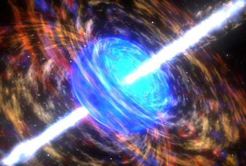
GRB 080916C -- which occurred on September 16, 2008 in the constellation Carina and recorded by the Fermi telescope has been confirmed to have "the greatest total energy, the fastest motions, and the highest-energy initial emissions" ever seen. The explosion had the power of about 9,000 ordinary supernovae, and the gas bullets emitting the initial gamma rays must have moved at 99.9999 percent the speed of light. The tremendous power and speed make this blast the most extreme recorded to date.Strong 6.1 Earthquake East Timor 09/16/08, Indonesian seismological officials said the earthquake was 6.3.Tuesday, September 16, 2008 07:15:41 PM, Earthquake measuring 4.7 shakes Maharashtra. The earthquake occured on Tuesday, September 16, 2008 at 21:47:14 UTC (Coordinated Universal Time ) and on Wednesday, September 17, 2008.
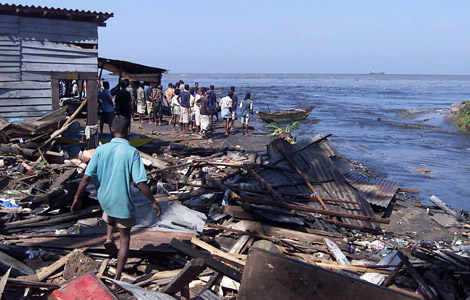
GRB 041227 -- This gamma ray blast, on December 27, 2004, was 100 times more intense than any burst that had been previously recorded, equaling the brightness of the full Moon, but radiating most of its energy at gamma ray wavelengths. Gamma ray counts spiked to a maximum in 1.5 seconds and then declined over a 5 minute period with 7.57 second pulsations. The blast temporarily changed the shape the Earth's ionosphere, distorting the transmission of long-wavelength radio signals. It is thought that gravity waves might have preceded the gamma rays.On December 26, 2004 a magnitude 9.3 earthquake occurred in the Indian Ocean off the coast of Sumatra in Malaysia. It caused a powerful tsunami which devastated coastal regions of many countries leaving over 240,000 people either dead or missing. It was the worst tsunami to affect this area since the 1883 explosion of Krakatao. The earthquake that produced it was so strong that it exceeded by a factor of 10 the next most powerful earthquake to occur anywhere in the past 25 years.
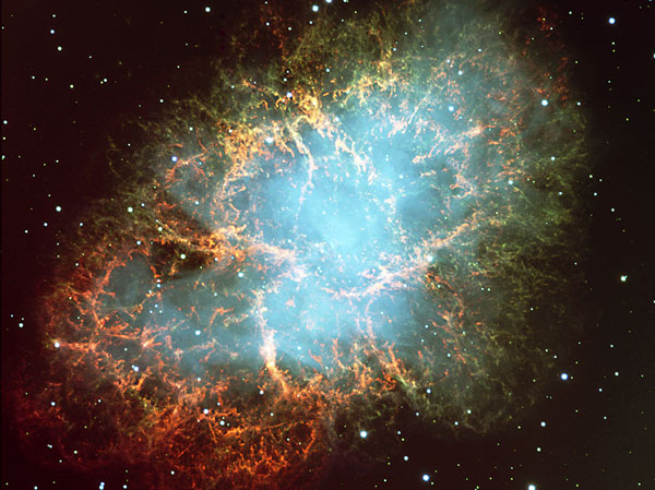
GRB 670702 -- On July 2, 1967, the first GRB, 670702, was detected by the Vela 4 satellite.A moderate earthquake measuring ML 4.1 (NCSN), Mw 4.1 (UCBSL) occurred at 17:33:53 UTC (10:33 a.m. local time),July 2, 1967 in the hills of Central California south of Hollister, but was too weak to topple any items from tables or shelves.

What causes the strange lights in the sky?
If this theory is correct, the gravity waves cause the earth to stretch and contract at points where it is vulnerable -- like at certain fault lines. This movement causes sudden friction that generates enormous energy. As this energy reaches the surface it is in the form of plasma, a very unique form of energy that usually forms a toroid or donut shape. The plasma then energizes the surrounding atmosphere as it dissipates and this is seen as a glow or illumination.

So what's the verdict?
It appears that there is a link between the gamma ray bursts and the strong earthquakes. But this link assumes that the gamma ray bursts were associated with strong gravity waves. Unfortunately we do not have a record of gravity waves as they are felt on earth. In fact, they are still only theoretical.

In 1918, Albert Einstein predicted that cosmic events, such as collapsing stars, would radiate a propagating distortion of space and time -- gravitational waves. But after spending hundreds of millions of dollars to detect them, scientists have still come up empty.
Physicists worldwide have been fine-tuning enormous, multimillion-dollar machines to filter out background noise so they can observe the unique signatures of a gravitation wave. Before the decade is out, they believe they'll record the percussive crash of colliding black holes or the vibrant hum of a pulsar -- a discovery that would be the proverbial shot heard around the scientific world.

Stefano Foffa [right] of the University of Geneva is a member of a leading gravitational-wave-detection team, which includes 33 other scientists from Switzerland and Italy. They recently submitted a report to Classical and Quantum Gravity that details their so-far fruitless attempts at observing tiny gravitational tugs and distortions on Explorer, a supercooled, 3-meter-long aluminum bar at the CERN particle physics lab in Switzerland.

Explorer is particularly well-tuned to sense spinning neutron stars, also known as pulsars, Foffa said. He and his colleagues estimate that some 200,000 of these spinning, super-dense objects -- so dense that a just sugar cube-sized amount weighs as much as the entire human race -- are scattered throughout the Milky Way.

But the thermal noise of even supercooled atoms is greater than the momentary twang the bar's atoms would experience when being plucked by a passing gravitational wave. So the Explorer group must use sensitive superconducting circuits to coax out a signal. It's an art that's still being perfected.


LIGO, the Caltech-MIT observatory, is an even bigger and more ambitious project than Explorer. To someone flying overhead, LIGO looks like an unfinished oil pipeline, with two mile-and-a-half long tubes jutting in perpendicular directions from a central building. The pipes (one in Livingston, Louisiana, and the other in Richmond, Washington), contain sensitive optics in which laser light bounces back and forth 100 times, then combines, allowing physicists to compare the two beams to monitor the space-time through which the light traveled.

The interference patterns from LIGO's two perpendicular laser beams sometimes momentarily jostle. If the same jostling happens at both LIGO's Louisiana and Washington detectors, and no earthquakes can explain the anomaly, then the source may well be a gravitational wave.

So, it's the million-dollar moment that hasn't yet happened. Or has it?
It could be that the effects of a relatively weak gravity wave can only be detected through the changes to some massive object, such as the earth's mantle. In that case the gravity wave theory may already have been validated by its association with earthquakes.
So there you have it.